Get the best tech on your deck
Platypus and BiobAse
Platypus has partnered with Biobase to offer integration of their Lowrance HDS-7 or Elite-TI chartplotter into each robotic platform we provide. These chartplotters collect quality sonar data that can be uploaded to Navico's BioBase, a cloud based platform that provides powerful processing and GIS data management capabilities (www.ciBiobase.com). Our partnership ensures reliable data collection and processing in an easy system that can be managed by a single operator, delivering you the information you need about your body of water!
TOGETHER, PLATYPUS AND NAVICO ARE REDUCING THE TIME, COST AND TECHNICAL SKILLS REQUIRED TO GENERATE QUALITY BATHYMETRIC AND VEGETATION MAPS
What makes this so powerful?
We are all but eliminating the manual labour required to create a detailed map of your chosen waterbody. Everything you need fits easily in the back of a small car, the platform can be run by a single person and you can be collecting data within a few minutes of arriving at your destination. Simply drop the boat into the water, designate the area you would like mapped on the included tablet computer, and relax on the shore while the robot completes the cold, dirty, boring and often dangerous work for you!
Need your data faster? Use multiple boats that work co-operatively. Is there shallow or hard-to-reach areas within your waterbody? A draft of only a few inches allows mapping of areas that manned boats would only dream of accessing! Map pond/lakes infrequently? Take advantage of our no upfront cost lease model and only pay when you use the robot. And the more you use our platform, the lower the cost to you!
Slash the time it takes you to map a waterbody! simply drop the boat and let it know where you need mapped. in no time you have uploaded your collected data and Biobase is delivering critical information about the water body to any internet enabled device you like! stop wasting time out on the water and contact platypus today!
BIOBASE CLOUD BASED PLATFORM
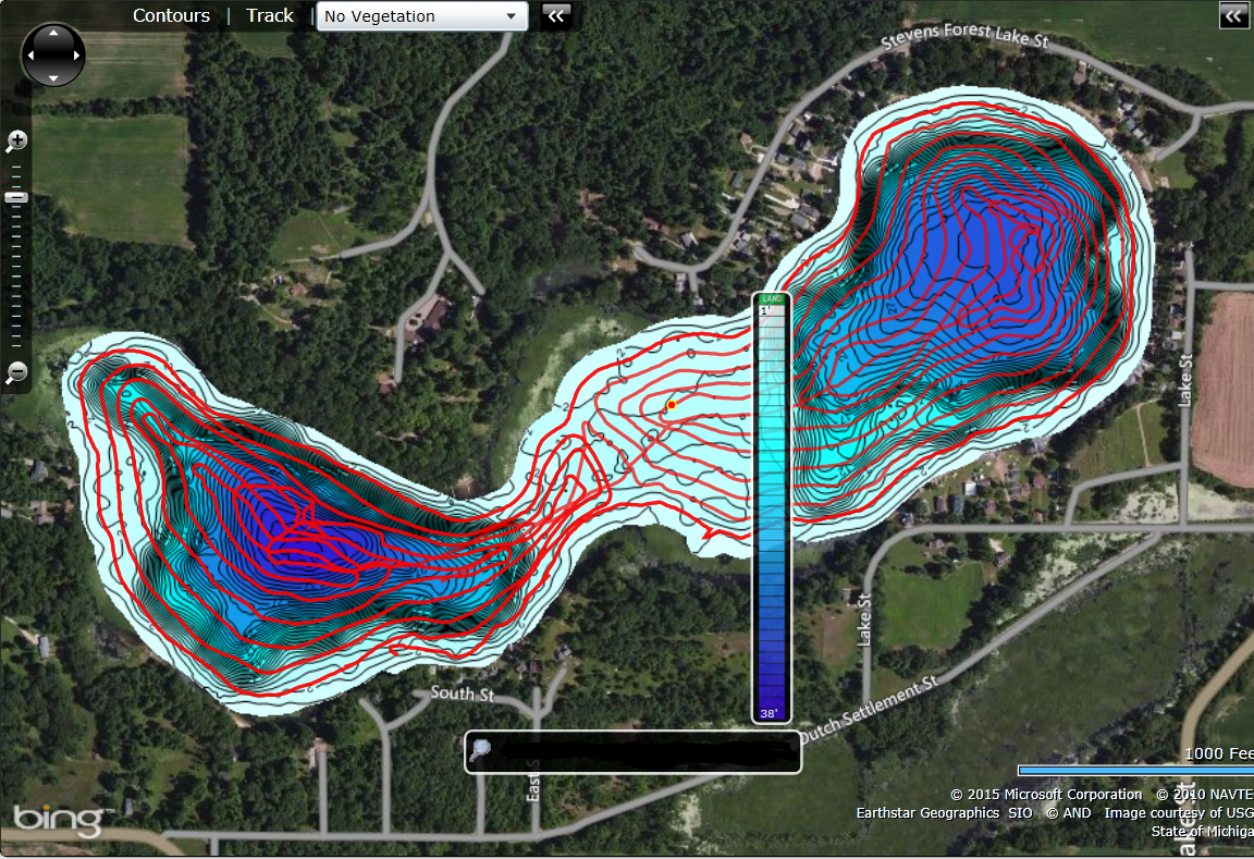
BioBase is a revolutionary cloud-based mapping solution that renders custom charts with bathymetric, aquatic vegetation, and bottom hardness data by applying a proprietary advanced acoustic algorithm. This acoustic data is acquired from the sonar log files gathered on the water by the Platypus robotic platform's integrated Lowrance HDS-7 or Elite TI.
By embedding the Lowrance unit deep within the boat's hull and securing the transducer at the optimal collection depth, we have created a mapping solution that ensures collected data exhibits minimal noise, allowing accurate processing by the Biobase system. Need more advanced GIS analysis? Simply download the collected data for your own processing.

Lowrance HDS-7 and Elite TI
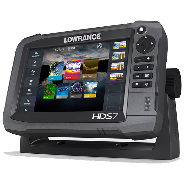
The Lowrance HDS-7 and Elite-TI use cutting-edge technology to provide navigation and chartplotting capabilities. When integrated into a Platypus robotic platform, they can create extensive sonar logs with high quality data of your water body. The combination of off-the-shelf marine technology and cutting-edge robotics, delivers a powerful system that saves time and costs. Add Lowrance's optional StructuteScan HD transducer to create stunning underwater images of lakes, rivers or the sea floor, all with your feet planted safely on the shore!